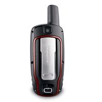
Garmin GPSMAP62 - naslednik serije 60

Matko

pohodnik
18. jul 2007
5.609
710
113
FW 2.80

Citat:
Change History
Changes made from version 2.70 to 2.80:

* Fixed shutdown related to the current track that occurred after updating the software
* Fixed a hang that occurred when a unit had 1000 auto-named waypoints
* Fixed issue with marine map points sometimes drawing with the incorrect symbol

Changes made from version 2.60 to 2.70:

* Added support for chirp™ (62s, 62st, 78s, 78sc).
* Fixed problem with certain custom maps.
* Fixed problem with certain JPEG images.
* Fixed issue with Sight 'N Go and user north reference (62s, 62st, 78s, 78sc).

Changes made from version 2.50 to 2.60:

* Fixed issue while using spell search in route planner.
* Fixed issue where tracks could not be disabled from the map.
* Fixed issues with odometer distance.
* Fixed shutdown while panning the map for extended periods of time.

http://www8.garmin.com/support/download_details.jsp?id=4995
 

Matko

pohodnik
18. jul 2007
5.609
710
113
Serija 62 / 78 ima spremenjeno upravljanje zemljevidov.
Vključi ali izključi se lahko samo celotna .img datoteka,
kar pomeni: Vsak zemljevid mora biti v svoji .img datoteki. :\Garmin\karkoli.img

Se pravi Adriaroute v Adriaroute.img, City Navigator v CNEU.img in nikakor ne oba skupaj v gmapsupp.img,
ker sicer ni možno izključit posameznega zemljevida.

Žal to ne velja za Garmin Custom Maps (.kmz), ali BirdsEye (.jnx),
ki se lahko "ugasnejo" samo vsi skupaj (ločeno za kmz in jnx), neodvisno od shranjevanja.
Kar v praksi pomeni, da na terenu ni možno preklapljat med dvema zemljevidoma istega območja.
frown-1.gif


Citat:
Map Selection Improvements

In the 62 and 78 series we have improved the way maps are enabled/disabled. Multiple supplemental map files can now be loaded to a device and to fully take advantage of that we have changed map selection to allow the greatest amount of configurability.

This may result in some people needing to change how they configure and load maps. In the past, only a single map file with multiple map sets was possible and accommodating different combinations on the unit was more difficult. Now, desired map set combinations can be built into multiple files prior to loading on the device and each of those files can then be independently enabled/disabled on the device. This allows a maximum amount of configurability while simplifying the setup needed on the device.

Our free utility, BaseCamp, supports multiple map files on a device. Build up any desired map sets that you would want to enable/disable independently and then transfer as before. Now, change the name of the new map file on the device from “gmapsupp.img” to a name that makes sense for the usage (e.g. “topo and roads for hiking trip.img”). This custom file name will show up in the map selection list on the device (Setup > Map > Map Information). If more configurability is desired on the device, split previously combined map sets into multiple map files (e.g. “topo for hiking trip.img” and “roads for hiking trip.img”). Utilizing profiles further enhances this option as multiple files can be enabled/disabled at the same time with a simple profile change.
http://garmin.blogs.com/softwareupdates/2010/09/map-selection-improvements.html

O profilih: http://garmin.blogs.com/softwareupdates/2009/08/make-the-perfect-handheld-with-profiles.html


In še nov beta FW.
Citat:
Change History
Changes made from version 2.91 to 2.92:

* Fixed issues with WAAAS/EGNOS
* Fixed issue with progress bar displaying properly on power up
* Fixed issue with track navigation not adding waypoints to the Active Route list when they are exactly equal to a track point
* Problems with the software may be reported to 62-78Beta@garmin.com

Changes made from version 2.90 to 2.91:

* Updated magnetic Earth field data
* Improved GPS performance
* Fixed issue with track navigation sometimes not adding waypoints to the Active Route list
* Fixed issue with track and route review from the map page if you came from the elevation plot
* Fixed issue with MPC map labels disappearing
* Fixed issue with gpi files that have alerts attached to the points
* Problems with the software may be reported to 62-78Beta@garmin.com
http://www8.garmin.com/support/download_details.jsp?id=5071
 

Matko

pohodnik
18. jul 2007
5.609
710
113
GPSMAP 62/78 software version 2.95 Beta
as of March 28, 2011

Citat:
Change History
Changes made from version 2.94 to 2.95:

* Fixed issues relating to WAAS performance.
* Fixed issue where the device would not regain a GPS signal after losing the GPS signal in a tunnel.
* Fixed shutdown on the map screen when a waypoint was being moved to the same location as a geocache or other POIs.
* Fixed issue where proximity waypoint alerts could only be set in feet regardless of what was selected as a Distance/Speed unit in the setup page.
* Fixed an issue where the enabled/disabled option for custom maps could not be changed when two or more BirdsEye™ Satellite Imagery providers were on the device.
* Fixed an issue where the device would not beep when approaching a destination while routing off-road.
* Problems with the software may be reported to 62-78Beta@garmin.com
http://www8.garmin.com/support/download_details.jsp?id=5071

PS: nov beta je tudi za Oregone,Dakoto
JNX Patcher v2.2 dela OK
 

Matko

pohodnik
18. jul 2007
5.609
710
113
Serija GPSMAP 62 je dobila modele s kamero (5 mega, avtofokus, geotag). V imenu imajo "c"
Okvirno 50EUR dražji, malenkost težji, z več spomina (2GB več) in energijsko potratnejši.

1225180-62sc.jpg


Citat:
We're wrapping up our exciting week of product announcements with an addition to the GPSMAP 62
series of rugged outdoor handheld devices – a built-in 5 megapixel camera with automatic geotagging to capture the highlights of any adventure and allow you to share the locations or navigate back to that site. We're showing off GPSMAP 62stc and GPSMAP 62sc here at the Teva Mountain Games in Vail, CO, capping four days of fun that included this and other big news in the popular eTrex, Rino and Astro families.


najava v blogu
http://garmin.blogs.com/my_web...-in-camera.html
opis serije
http://sites.garmin.com/gpsmap62/info/
model 62sc
https://buy.garmin.com/shop/shop.do?cID=145&pID=89556&ra=true
primerjava 62s / 62sc
https://buy.garmin.com/shop/compare.do?cID=145&compareProduct=89556&compareProduct=63801
1225180-62sc.jpg
 

Priponke

  • 1225180-62sc.jpg
    1225180-62sc.jpg
    49,3 KB · Ogledi: 296

Matko

pohodnik
18. jul 2007
5.609
710
113
GPSMAP 62/78 software version 3.02 Beta
as of July 12, 2011

Citat:
Change History
Changes made from version 3.00 to 3.02:

* Added Garmin Spanner mode to GPSMAP 78, GPSMAP 78s, and GPSMAP 78sc devices.
* Fixed issue with setting proximity alerts. The unit of measure can be changed by entering the 'Proximity Alarms' page, pressing the 'Menu' key, and selecting 'Change Units'

http://www8.garmin.com/software/GPSMAP62_78_302Beta.exe
 

Matko

pohodnik
18. jul 2007
5.609
710
113
GPSMAP 62/78 (WebUpdater) software version 3.10
as of August 3, 2011

Citat:
Change History
Changes made from version 3.00 to 3.10:

* Added Garmin Spanner mode to GPSMAP 78, GPSMAP 78s, and GPSMAP 78sc devices
* Fixed issue with multilingual custom POI files
* Fixed issue with setting proximity alerts. The unit of measure can be changed by entering the 'Proximity Alarms' page, pressing the 'Menu' key, and selecting 'Change Units'

http://www.garmin.com/software/GPSMAP62_78_WebUpdater__310.gcd
http://www8.garmin.com/support/download_details.jsp?id=4995

PS: aktualni JNX FW patcher v2.5 ne dela več
frown-1.gif
 

krimec

Majstr
7. maj 2011
3.811
129
63
Ima še kdo tak problem? Pri GPSMAP 62s shraniš trenutno pot, ne da bi jo preimenoval - shraniš jo pač pod imenom kot ti ga naprava ponudi (datum, ura). Ko jo pozneje na napravi preimenuješ v bolj prijazno ime ti ga naprava prikaže, ob prenosu v Map source ali podoben program za pregled poti na zemljevidu pa se zopet pojavi prvotno ime. Ko pot preimenuješ že ob prvem shranjevanju na napravi, pa je to ime poti identično na napravi in v Map sourcu. Tudi v Raziskovalcu ali Total comanderju je prikaz isti. Mogoče gre za sistemsko napako, ali pa delam kaj narobe.
sprasujem se.gif
 

Matko

pohodnik
18. jul 2007
5.609
710
113
Mapsource prikaže ime sledi,

medtem, kot raziskovalec prikaže ime datoteke.

Očitno naprava kasneje preimenuje samo ime datoteke.

ps: kateri FW?
 

krimec

Majstr
7. maj 2011
3.811
129
63
FW 3.0 in pa FW 3.1. Ni razlike. Saj se da v Raziskovalcu preimenovati ime, samo če jih imaš več, moraš vsakič pogledati pot v Map sourcu, da veš kaj je kaj. Sama naprava pa deluje bp. Zamenjal sem datoteko za slovenski prevod, dobil sem jo na: www.volontar.net, kot priponko v članku o GPSMAP 62s, tako da je prevod malo bolj prijazen.
 

Matko

pohodnik
18. jul 2007
5.609
710
113
Očitno hrošč.

Upam, da "popotnik" napiše kateri email, je uporaben za prijavo napak.
Tisti splošni se očitno izgubi nekje na dnu predala.

Lahko poskusiš še reset naprave na tovarniške nastavitve, včasih se pri nadgradnji FW,
kaj spremeni in pomaga samo reset.

ps: Naj kakšen uporabnik Oregona napiše, kako je pri njem.
 

krimec

Majstr
7. maj 2011
3.811
129
63
Še ena težavica. Ko imaš več točk poti, pa hočeš izbrisati samo eno, ti naprava vedno ponudi samo "izbriši vse". Je kdo odkril, kako bi na GPSMAP 62s lahko brisal samo posamezne točke poti. FW je 3.10. Še en Hrošč?
 

krimec

Majstr
7. maj 2011
3.811
129
63
GPSMAP 62/78 (WebUpdater) software version 3.40
as of August 19, 2011

Res bo nekaj z ukinitvijo podpore za MapSource, saj moraš pred to posodobitvijo vse točke in poti z naprave poslati v Basecamp.

Notes:
Important steps for future BaseCamp Compatibility:
If you are a user of BaseCamp now, or plan to be in the future, you must follow these steps to ensure your data is protected during this software update:
Connect your handheld unit to a computer and launch BaseCamp. Transfer all tracks, routes and waypoints to BaseCamp.
Delete the /Garmin/GPX folder from the handheld's mass storage.
Update the handheld's software via WebUpdater and reboot the handheld.
Reconnect the handheld to a computer and transfer your data from BaseCamp back to the handheld.

--------------------------------------------------------------------------------

Change History
Changes made from version 3.00 to 3.40:
Added support for advanced geocache logging with OpenCaching.com. See TrailTech (http://garmin.blogs.com/softwareupdates/2011/08/advanced-geocache-logging-with-opencachingcom.html) for more information.
Added Garmin Spanner mode to GPSMAP 78, GPSMAP 78s, and GPSMAP 78sc devices
Fixed issue with multilingual custom POI files
Fixed issue with setting proximity alerts. The unit of measure can be changed by entering the 'Proximity Alarms' page, pressing the 'Menu' key, and selecting 'Change Units'
 

Matko

pohodnik
18. jul 2007
5.609
710
113
GPSMAP 62/78 (WebUpdater) software version 3.50

as of October 26, 2011

Citat:
Change History
Changes made from version 3.40 to 3.50:

* Added Photo Viewer application
* Improvements to the geocaching experience. See TrailTech (http://garmin.blogs.com/softwareupdates/2011/09/improved-geocaching.html) for more information.
* Fixed a potential hang on startup when importing large numbers of waypoints, tracks, routes, or geocaches
* Fixed issue with very long geocache descriptions
* Fixed shutdown when reviewing certain geocache descriptions
* Fixed issue where some auto-archived tracks would be named in English regardless of user language
* Fixed bug that could cause some geocaches to not import
* Fixed issue with track log recording while using the stopwatch
* Fixed issue with the anchor drag alarm
* Fixed issue with total ascent and total descent fields not displaying values greater than 9999 meters
* Modified default map trails to appear as dashed red lines
* Fixed potential issue with screenshot color reproduction

http://www.garmin.com/software/GPSMAP62_78_WebUpdater__350.gcd
http://www8.garmin.com/support/download_details.jsp?id=4995


Isti popravki so tudi za GPSMAP 62sc/62stc FW v2.60
http://www.garmin.com/software/GPSMAP62sc_62stc_WebUpdater__260.gcd
http://www8.garmin.com/support/download_details.jsp?id=5559

PS: JNX FW patcher v2.9 deluje

OPOZORILO: Uporabniki sporočajo, da je FW hroščat, aparat se ugaša in barometer več ne dela.
frown-1.gif
 
Nazadnje urejeno:

Matko

pohodnik
18. jul 2007
5.609
710
113

Matko

pohodnik
18. jul 2007
5.609
710
113
GPSMAP 62/78 (WebUpdater) software version 3.80
as of January 11, 2012

Citat:
Change History
Changes made from version 3.60 to 3.80:

* Added Geocaching with Photos (http://garmin.blogs.com/softwareupdates/2012/01/geocaching-with-photos.html)
* Improved elevation data stored in track logs
* Fixed issue with 'Hut' point type in TOPO Australia & New Zealand maps
* Fixed issue with magnetic north offset when projecting a waypoint
http://www8.garmin.com/support/download_details.jsp?id=4995

http://www.garmin.com/software/GPSMAP62_78_WebUpdater__380.gcd
 

Matko

pohodnik
18. jul 2007
5.609
710
113
GPSMAP 62/78 software version 4.03 Beta
as of May 18, 2012
Citat:

Change History
Changes made from version 3.90 to 4.03:

* Added new route activity types
* Added support for Kenwood NMEA Waypoint Sentence
* Improved GPS response at low speeds
* Fixed issue with preserving routes imported from Basecamp (identical maps required)
* Fixed Spell Search in German
* Problems with this beta software may be reported to 62-78Beta@garmin.com

Changes made from version 3.80 to 3.90:

* Added symbol filtering to FIND > Waypoints and Waypoint Manager
* Improved GPS response at low speeds
* Fixed daylight saving time issue in Sun and Moon application
* Fixed issue that could occur when restoring map zoom level defaults
* Fixed issues with support for Canada BlueChart g2 maps

http://www8.garmin.com/software/GPSMAP62_78_403Beta.exe
 

Matko

pohodnik
18. jul 2007
5.609
710
113
GPSMAP 62/78 software version 4.10
May 25, 2012

Citat:

Change History
Changes made from version 3.90 to 4.10:

Added new route activity types and improved BaseCamp compatibility. See TrailTech (http://garmin.blogs.com/softwareupdates/2012/05/get-active-with-garmin.html) for more information.
Added support for Kenwood NMEA Waypoint Sentence
Improved GPS response at low speeds
Fixed Spell Search in German
Problems with this software may be reported to 62-78Beta@garmin.com

http://www8.garmin.com/software/GPSMAP62_78_410.exe 4.5MB


Beta FW ima podporo za nove načina vodenja (ne samo najhitrejša, ali najkrajša pot, ampak tudi takšna, ki prinese minimalno višinsko razliko in podobno), ki bodo prišli v poštev pri novih topo zemljevidih (najprej Nemčija in Alpski lok).

ps: Beta FW so izšli tudi za Montano, Oregona, Dakoto,...